Second yellow warning for snow and ice issued for the North East by Met Office
and live on Freeview channel 276
Forecasters first shared the alert today, Saturday, January 2, at 10am and said it would run until 6pm, but has now put out a second warning for the conditions, which warns of the conditions until 11am tomorrow.
It covers across the North East, with people told the snowfall may cause “tricky travel conditions in places" with some roads and railways likely to be affected with longer journey times by road, bus and train services.
Advertisement
Hide AdAdvertisement
Hide AdIt also warns of injuries from slips and falls on icy surfaces and the chance of icy patches on some untreated roads, pavements and cycle paths.
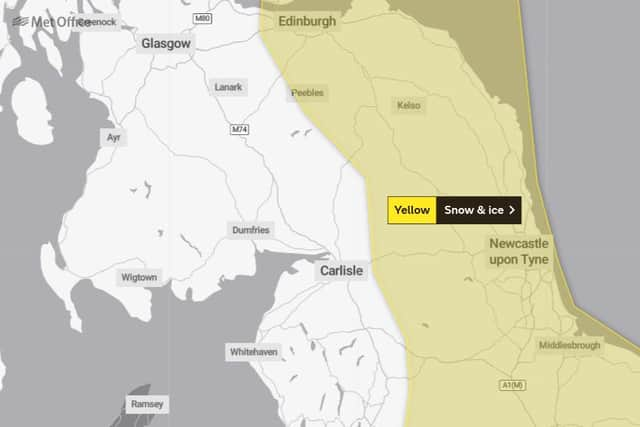

The Met Office said: “Icy patches are expected to develop, especially on untreated surfaces, where snow has fallen on Saturday and where showers are frequent this evening and overnight.
"Showers will also be wintry at times, mainly inland and particularly over higher ground where above 200cm to 300m a further few centimetres of snow is possible in places.”
The first warning said there would be southward-moving areas of sleet and snow which were likely to give 2cm to 5cm snow over higher ground, while at lower levels snow accumulations were expected to be smaller and patchier in nature with 1cm to 2cm snow for some areas.

Advertisement
Hide AdAdvertisement
Hide AdThe region’s forecast for tonight is cloudy with further outbreaks of showery rain and hill snow expected.
The most frequent and heaviest of the showers will be along North Sea coast, but it will not be as cold as recent nights, with a minimum temperature 0C.
Tomorrow, Sunday, January 3, it predicts further showers feeding in from the North Sea, these merging to give longer spells of rain and some hill snow.
It will feeling cold in a light to moderate east northeasterly wind, with the temperature to only get as warm as 3C.
Advertisement
Hide AdAdvertisement
Hide AdThe outlook for Monday to Wednesday is that it will stay cold and showery, with the showers turning wintry, especially on hills, but not exclusively.
Frost and icy patches will form after cold nights.