Met Office snow and ice warning extended as temperatures could plunge to -5


Met Office forecasters have issued a yellow warning for snow and ice from 12am on Thursday, February 11, with the alert due to run until 12pm on Friday, February 12.
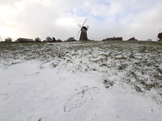
Areas across the North East saw snowfall earlier in the week but further snow showers will not be as heavy or as frequent as those experienced over the past few days.
Advertisement
Hide AdAdvertisement
Hide AdA Met Office Statement online said: “Further snow showers are expected to continue to affect parts of northeast England and northern and eastern Scotland.
“Whilst these are not expected to be as heavy or widespread as earlier in the week, some persistent bands of snow showers may develop in places.
“Accumulations of 1-3 cm are likely with 5-8 cm possible where more persistent bands of snow develop.
"Icy stretches are possible overnight where surfaces are left wet from the partial melt of lying snow during the daytime."
Advertisement
Hide AdAdvertisement
Hide AdThe Met office say the North East forecast today, Tuesday will be snowy showers with some brightness between showers, with icy conditions and a bitterly cold easterly wind - strong near coasts.
Tonight will see snow and hail showers continue overnight, with some brief clear spells but bitterly cold conditions with a hard frost and temperatures could drop to as cold as -5C.
Snow showers will continue on Wednesday but might turn lighter and less frequent later, with some bright or sunny spells.
Thursday will be drier and brighter with light winds but cold temperatures are expected to create icy stretches overnight where surfaces are left wet.
Advertisement
Hide AdAdvertisement
Hide AdStrong southeasterly winds are predicted to develop on Friday, staying very cold.
The initial yellow alert for snow issued by the Met Office was already extended up until midnight on Wednesday, February 10, which covered the entire east of the UK.
The Met Office say the warning may affect some roads and railways with longer journey times by road, bus and train services.
Forecasters warn of icy surfaces and ice patches on untreated roads, pavements and and cycle paths.