Walking in the footsteps of the saints


Apart from its fascinating landscape, and the history with which it is saturated, the fact that the rising tides separate it from the mainland twice a day makes it one of those places that everyone wants to visit.
Sadly, this popularity can make it extremely busy, somewhat detracting from the very spirit that visitors are trying to find. The queues of cars waiting for the receding tide to clear the causeway can stretch a long way.
It was not always so, of course.
Advertisement
Hide AdAdvertisement
Hide AdThe main part of the causeway that we use today was built in 1954, with the road along the shoreline being paved in 1965. Before then, rusty old cars used to make the crossing. These ‘taxis’ were dedicated to the route across the sands and would have been totally unusable on normal roads.
Prior to 1954, the crossing was made by horse and cart. Richard Perry, in his book A Naturalist On Lindisfarne, wrote about his crossing in 1936.
He wrote: “We clip-clopped down the long hill to a strip of salting and out over the tide-wet mud to a line of poles, encrusted with barnacles up to the high-water mark. Stuck up at 20 or 30-yard intervals, they signposted the way through the ford to the nearest part of the island, a mile distant.
“Another line of poles, a little to the south, stretched away across the flats further than I could follow them for nearly three miles to the southern arm of the island – the unshod Pilgrims’ Way.”
Advertisement
Hide AdAdvertisement
Hide AdI have long been fascinated by this Pilgrims’ Way, but have been over cautious in worrying about hazards that might exist, which has meant I have avoided this path and joined the rest of the visitors in driving across the causeway.
Last year, I took the opportunity to join a guided walk, organised by the Peregrini Lindisfarne Landscape Partnership and led by Patrick, of Footsteps.
And what a revelation it was!
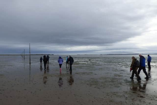
Parking at the mainland end of the causeway, beside the lines of concrete tank traps, we walked along the causeway as far as the bridge, where the South Low continually runs.
From here, where the refuge hut sits on its stilts, the poles of the pilgrims’ way head off to the right, directly towards Chare Ends, where the old taxis would deposit their fares.
Advertisement
Hide AdAdvertisement
Hide AdThe walking is wet and muddy. Our boots were quickly filled with water so wellies or bare feet are the best option.
The way, however, is clearly marked, and over this last winter, a number of missing poles have been replaced, making the route even more clear.
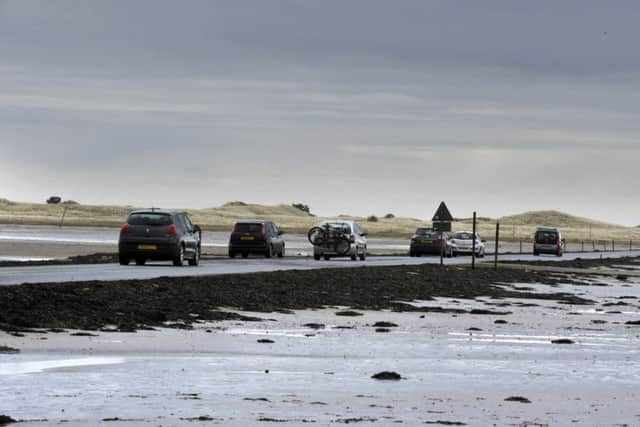
We crossed during what was half-term, and the stream of cars crossing the causeway was almost continuous.
But within a few minutes, we were away from this and delighting in the peace and quiet. The noise of the cars was soon lost in the sound of the wind and the wailing of the seals basking on the shoreline.
Advertisement
Hide AdAdvertisement
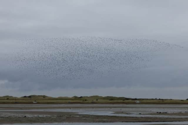
Hide AdFlocks of birds swooped around the mud flats, taking advantage of the feeding opportunities provided by this pristine environment.
The small snails that are prolific in the autumn make a great attraction for the visiting geese. We witnessed a ‘murmuration’ of about 3,000 golden plovers, a memory that will stay for a long time.
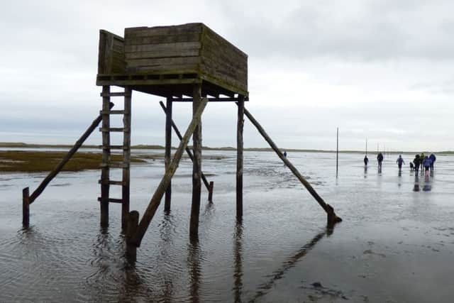
Along the way are a couple of refuge towers, which would provide a place of safety for anyone caught by the rising tide, though one of them was a little precarious. Hopefully, this can be repaired at some time.
After about three miles we made landfall on the island, and it was just a short walk into the village for a little exploration.
Advertisement
Hide AdAdvertisement
Hide AdBut after a bit of the hustle and bustle, it was wonderful to get back to Chare Ends for the peace of the return walk, which was just as delightful as the walk out.
This Pilgrims’ Way has a long history. It is likely that this was the route used by the earliest people who inhabited the island, and following the establishment of the monastery, it would have been used by the many pilgrims who were drawn to this early Christian site, which, at this time, was a centre of enlightenment set within a turbulent country.
It was the centre of what has become known as the Golden Age of Northumbria, which created such treasures as the Lindisfarne Gospels.
It is humbling to think that we are walking in the footsteps of St Aidan and St Cuthbert.
Advertisement
Hide AdAdvertisement
Hide AdI have just one regret about walking the Pilgrims’ Way, and that was that I had waited so many years to do it. My fears were totally unfounded. The route is safe as long as you plan ahead, wear appropriate clothing and follow advice and local signs, particularly those associated with tide times.
And, of course, as with any outdoor activity, always respect the Countryside Code – leave no trace of your visit, take your litter home and keep dogs under close control. This last point is very important. A dog running free can cause havoc in an environment such as this, with its profusion of birdlife.