Drivers face difficult conditions after snowfalls across Northumberland overnight
and live on Freeview channel 276
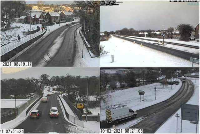
Images taken from the North East Traffic Camera network shows how the roads have been left covered in snow overnight across the North East.
Its Twitter feed, @NELiveTraffic, said traffic was moving well, despite the “unfavourable” conditions.
Advertisement
Hide AdAdvertisement
Hide AdMet Office meteorologist Clare Nasir said “temperatures will plummet wherever you are” today, Wednesday, February 10, and “strong winds” and snow will be “disruptive across many areas” in the UK.
Northumberland County Council said: “Take care if you are out and about this morning.
“Snow is continuing to fall.
“Our gritters have been out all night but grit needs movement over it to start working.
"Please be careful on the roads and extra vigilant on the untreated areas.”

Advertisement
Hide AdAdvertisement
Hide AdDetails of its road gritting, ploughing, grit bins and gritter routes can be found by clicking here.
The council also runs the snow warden scheme, which sees a person or a group clear snow and ice from footpaths in their area.
It says some roads and railways likely to be affected with longer journey times by road, bus and train services, while people should take care on foot, as there is an increased chance of injuries from slips and falls on icy surfaces.
Advertisement
Hide AdAdvertisement
Hide AdThe Met Office has also said there will be some icy patches on some untreated roads, pavements and cycle paths.
While snow showers are not expected to be as heavy or widespread as earlier in the week, its forecasters predict some persistent bands of snow showers.
It says between 5cm and 8cm of snow could fall in areas where there are longer flurries.
It added: “Icy stretches are possible overnight where surfaces are left wet from the partial melt of lying snow during the daytime.”
Advertisement
Hide AdAdvertisement
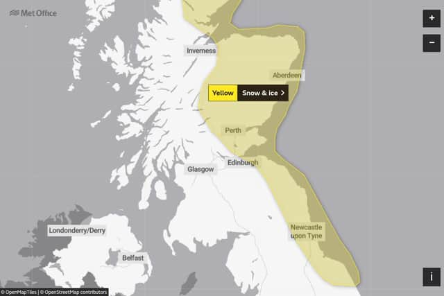
Hide AdBut while the North East’s temperatures are expected to remain between -2C and up to 3C, the Met Office has said areas of Scotland had already experienced conditions of down to -16C overnight.