
What Are Those Signs For?
Residents and recent visitors to Rothbury and Whitton may have seen two curious blank signs that have appeared; one between the Haugh and the bridge and the other at the top of Whitton Bank and wonder why we need more signage in our rural community.
Well, this is not another waste of public money with more unnecessary street furniture littering our highway, but rather an essential tool within an important initiative to avoid serious risk to life during flooding. When activated, these drop-down signs will warn drivers and pedestrians that the road is flooded and closed.
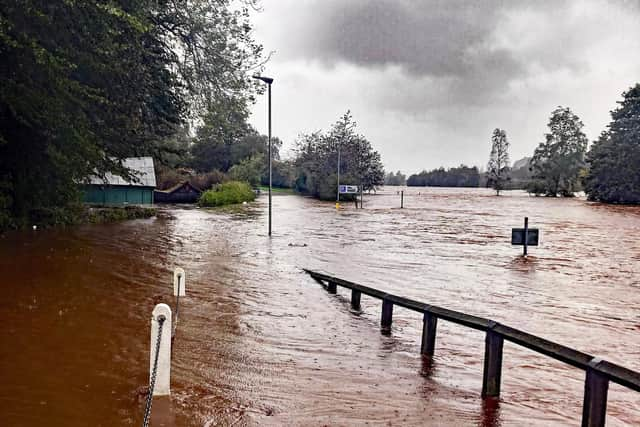
Over the years flooding of the road at the Haugh between Rothbury and Whitton has been a major problem. Several cars have become stranded and written off when drivers have taken the risk to go through the floodwaters. The picture taken during Storm Babette shows the flooded road and illustrates the necessity of having signs to warn the public not to attempt to use the road during floods. The flood water is about 1.5 metres deep in this photo and shows the water to be quite turbulent, with a serious possibility of cars getting washed away.
As we all know, storms and floods are becoming more frequent due to climate change, and local communities need to be geared up to deal with this. We cannot always rely on the emergency services. The introduction of the signs follows a project between the Environment Agency (EA) and the Whitton & Tosson Parish Council. The EA has been working with local communities to develop and introduce detailed flood plans, which will combine the use of local volunteers and the emergency services to provide an integrated plan of action that will be implemented whenever there is a risk of flooding.
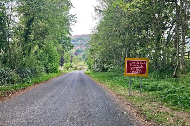

The Whitton & Tosson Flood Plan is led by Alan Winlow and a team of volunteer wardens from the community and Parish Council. During times of serious storms and heavy rains, Alan and his team will be closely monitoring water levels around the parish, and particularly at the Haugh. Whenever the water levels become dangerously high, the volunteers will activate the drop-down signs.
The Parish Council took their concerns about flooding at the Haugh to the County Council Highways Department and requested the introduction of flood warning signage. Highways responded immediately, and together the Parish and County Councils designed this flood warning system, which the County Council provided and installed free of charge.
This is not the only recent joint flood prevention venture between the Whitton and Tosson Parish Council and the Northumberland County Council. Flooding of the Ryehill cottages was a serious problem due to the burn overflowing. Alan Winlow devised a flood solution that included strengthening and heightening the embankment. A joint project with a team from Highways and volunteers from the community has been undertaken to significantly reduce the risk of flooding in the future.
The initiatives in the article were prompted by Whitton and Tosson Parish Council carrying out a flood risk assessment because storms and floods are becoming more frequent due to climate change. It was agreed that the areas at the highest risk were the road flooding by the Haugh Car Park, the flood risk to the Ryehill Cottages, and the erosion of the road at Ryehill.
These projects demonstrate the importance of bringing together statutory services and the community to deal with key local issues. It would be a great step forward if other Parish Councils agreed to conduct Flood Risk assessments to prepare for future events.