Morpathia: A nice day out in Matfen


Apart, however, from going to the Village Store for ginger beer (me) and tea and coffee (everybody else) we had nothing to do with Matfen itself – our place was in the open countryside.
It isn’t a walk I should like to do on my own. The footpaths are shown on the OS maps, but there’s rarely any trace of them on the ground. Sometimes, even the expert walkers amongst us had to confer before deciding where our route lay.
Advertisement
Hide AdAdvertisement
Hide AdThere were two lost medieval villages on our walk. The first was Clarewood. It consists now of two farmhouses, a bungalow and a superior holiday let in a converted gin-gang.
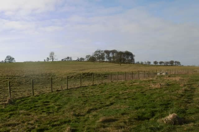
In front of the first farmhouse is a row of half a dozen single-storey cottages – you can perhaps make out two chimneys in our picture.
What was shocking was that none of these places, where one assumes people lived and brought up their families, had any windows, but only the door.
Walking up towards a small copse on the skyline, a field of rig and furrow stood out clearly on our left. (If you go on Google Earth they stand out even better from the sky, each strip ending with a shallow turn to the left where the ox- or horse-drawn plough turned round.)
Advertisement
Hide AdAdvertisement
Hide AdWe were fortunate to have a local historian in our company, who pointed out the village site and the rigs.
Medieval villages usually had three fields, two being cropped and one left fallow. Agriculture was communal. Everybody grew the same crop in any one field.
The rigs – also called ridges – are the fossilised strips by which the villagers shared out the land amongst themselves.
Landscapes have secrets and the surprising thing about this one is that, although it’s totally rural now, there used to be coal pits on the other side of the hill, just beyond the trees.
Advertisement
Hide AdAdvertisement
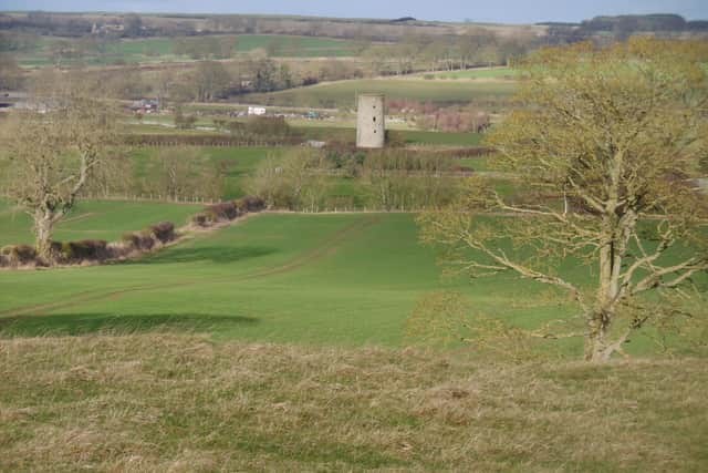
Hide AdTo the north is a rich agricultural plain with Great Whittington windmill in the centre. Not far away is Whittington Mill, a former watermill, now an upmarket housing development.
Although it stands on the River Pont, from the air it looks very much as if it was powered by an enormously long leet, possibly coming from the Bowbridge Burn over half a mile away to the west.
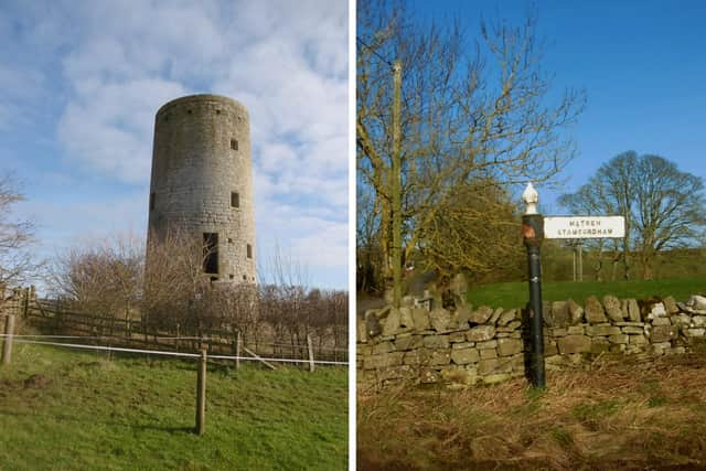
All that’s left of the windmill is its tower. On top of it was the wooden cap from which the sails projected, which could be turned in any direction to face the wind.
The miller and his assistants needed to be strong to hump the sacks of grain and manage the machinery, but a mill – whether water- or wind-powered – was a sophisticated piece of engineering, full of labour saving devices.
Advertisement
Hide AdAdvertisement
Hide AdIn its most developed form, the sails powered not only the great millstones but the hoist to raise the sacks up to the top floor – this one had four floors, as you can see – but it could also have a mechanism mounted on the back of the cap, called a fantail, which automatically turned the sails to face the wind.
The sacks were hoisted to the top floor so that the grain went from one to another of its remaining stages purely by gravity, though this was also helped by a device called a jigger, again driven from the mill shaft, which shook the wooden shutes to make the milled product run. Clever!
As you can see in the picture, there were two doorways – one at ground and another at first floor level. The latter was called a pitching door, from where the sacks of flour (or whatever) were loaded onto carts and taken away.
At Great Whittington we split into two parties, one going to Matfen the long way round and the other by a direct route. I took the second option.
Advertisement
Hide AdAdvertisement
Hide AdJust outside the village we came across a rarity – one of the old, cast iron, county council signposts, pointing us to where we were going.
Matfen is dominated by the Hall, which is still the centre of a great estate. Matfen Estates is a large and diverse enterprise.
Don’t imagine that all the world’s work goes on in industrial estates and business parks. A fair bit goes on at Matfen as well.
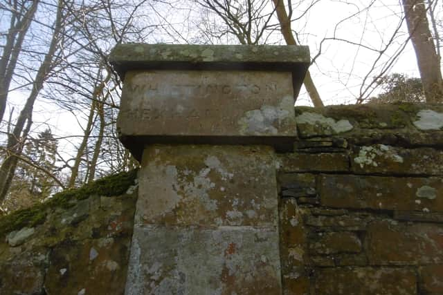
Just outside the village, not far from the main entrance to the Hall, I came across another relic of a bygone age. In the 18th and 19th centuries, whenever a turnpike trust was given charge of a stretch of road, one of the conditions was that the trustees should put milestones or other markers at roughly one-mile intervals, telling the traveller where the road was going to and how far it was.
Advertisement
Hide AdAdvertisement
Hide AdIn this case, the thrifty trustees used the top of a pillar at the corner of an estate wall. It reads: “Whittington 1¾ miles / Hexham 9 miles”.
The long distance party caught up with us just as we were finishing our refreshments and we re-formed into two new groups, one going straight back to the cars and the other completing the remainder of the planned walk.
I chose the latter because I wanted to see our second lost village, and even more the Matfen standing stone.
On the way, we passed through a field of sheep. Some ewes were coming through the open gate from an adjoining field, evidently by their own inclination since there was neither dog nor shepherd in sight. The last one left it a bit late and, seeing us, bolted through at the last minute.
Advertisement
Hide AdAdvertisement
Hide AdWhen we got to the gate, all became clear. A big feeding ring full of hay stood just inside, fenced off from the rest of that field with hurdles. We had disturbed their lunch!
It soon became obvious why the sheep were only allowed into one corner of the second field. The rest of it was thick clarts.
After that, however, we were on farm roads for the rest of the way. The second lost medieval village was called East Matfen and once again all that’s left of it is a farm of the same name.
Our historian told us that both Clarewood and East Matfen were bought by the same man, a rich Newcastle lawyer, under whom the villages were abandoned and the great open fields turned over to grass.
Advertisement
Hide AdAdvertisement
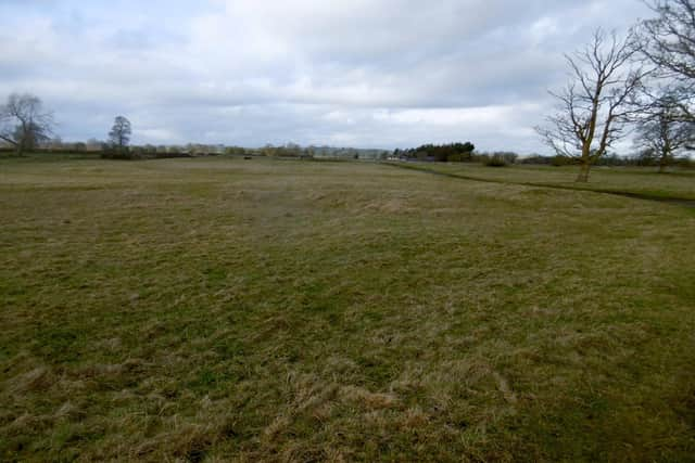
Hide AdIn this case, the abandoned village is a quarter of a mile from its later namesake. The humps and bumps are visible enough on the ground, but what they once were, it’s impossible to say.
The standing stone, with its grooves and cup marks, is an impressive monument. Standing stones are older than almost everything else on a logarithmic scale.
Dating them is beyond difficult, but estimates vary from around 5,000 BC to 3,000 BC.
It was the fashion for 18th and 19th century landowners to adorn their estates with what they believed were ‘Druidical’ stones and the one at Matfen is thought to have been brought, probably from Ingoe.