Morpathia: A castle, a steam railway and a POW camp

In Morpeth, actually, and all within a mile of Telford Bridge. Today, however, we go further afield. Now that Morpathia appears on the Northumberland Gazette website only, it will be appropriate to extend our scope occasionally beyond our immediate home territory – and in this instance to the South Tyne Valley.
Earlier this month, I went with a walking group to Featherstone Castle. We parked beside the track of the former Haltwhistle to Alston branch of the Newcastle and Carlisle railway, close to a pub called the Wallace Arms. The Wallaces were the owners of Featherstone Castle and the castle as it is today is largely due to them.
Advertisement
Hide AdAdvertisement
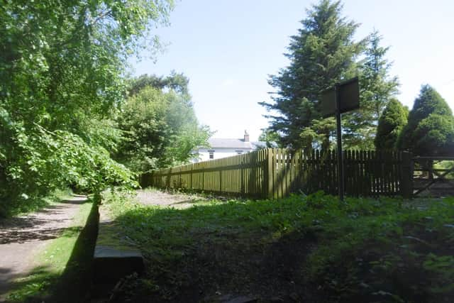
Hide AdThe estate belonging to it is known as Featherstone Park and close to where we began our walk is the former Featherstone Park Halt with its elegant station house. It was quite usual in the 19th Century for the nobility and landed gentry to have their own private station on a railway line. The estate village, known simply as Park, used to have its own informal halt about half a mile further back.
The line of the former Alston branch has been beautifully restored and is ideal for walking or cycling. There are lots of trees along it with some fine views across the South Tyne Valley.
A pleasant stroll of about a mile brought us to Coanwood Halt. The former station house stands far enough back for privacy and there are intriguing reminders of a working steam railway.
One of these is the platform. The line, which was built mainly to carry lead, coal and limestone from the mines of the North Pennines to Haltwhistle and thence to the wider world, was single track, so the stations only needed a platform on one side.
Advertisement
Hide AdAdvertisement
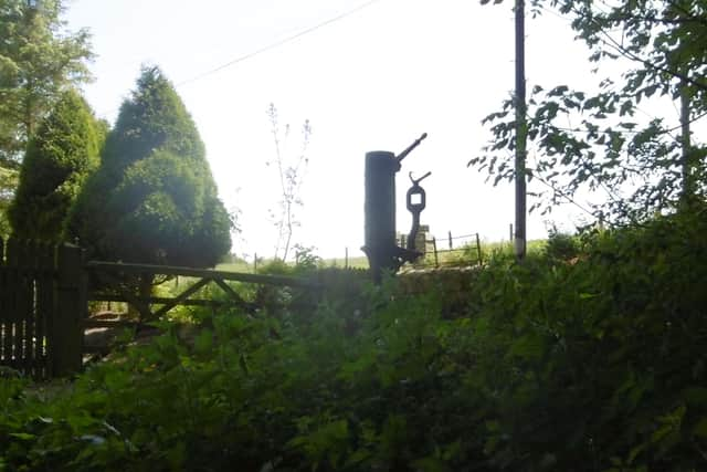
Hide AdAnother is a sturdy cast iron pump, which I suppose was the lower part of a water crane for replenishing the locomotives’ boiler water. By railway standards there were some steep gradients on this line and the loads were heavy.
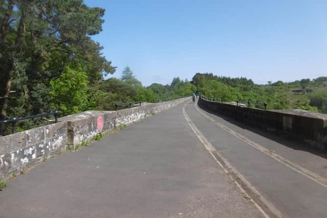
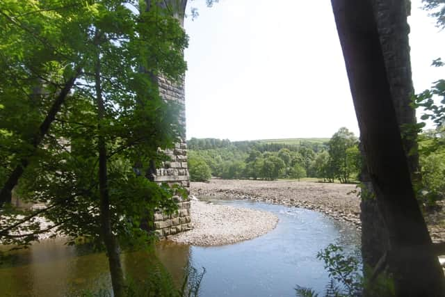
Another half mile, part of it on a high embankment overlooking the South Tyne Valley, brought us to Lambley Viaduct, with even better views.
The viaduct itself is both slender and graceful, and it gives one pause for thought that this amazing structure, together with all the other bridges, cuttings and embankments required, was paid for out of the produce of the local mines. The mining industry of the North Pennines must have been absolutely enormous.
While we were admiring the view from the viaduct, an elderly gentleman rode up on his bicycle with the evident intention of going further – but he couldn’t. The line is closed off at the end of the viaduct with a substantial fence because after that it runs through the grounds of a private residence, the former Lambley Station House.
Advertisement
Hide AdAdvertisement
Hide AdVery reasonably, the occupiers don’t want people traipsing through their garden!
As a result, the walking path descends to river level, first by an impressive iron staircase then by a steep footpath. After that it goes under the viaduct and rejoins former the railway track some way further south.
A branch went off at this point to join a much older line called the Brampton Railway. This was built in 1798 by the Earl of Carlisle – who, of course, was Lord of the Manor and Borough of Morpeth – to carry coals to Brampton from his collieries on Tindale Fell. It was originally operated by horses and inclined planes, and indeed parts of it were even older, having been small local waggonways close to the collieries.
It converted to steam haulage between 1837 and 1839 and carried coal, limestone, whinstone and shale for brick-making, but it closed in 1953 following the nationalisation of the coal mines.
Advertisement
Hide AdAdvertisement
Hide AdA walk of about a mile and a half, partly on the left bank of the river then over a footbridge to rejoin the right-hand side, brought us to Camp 18 where we had lunch.
There’s quite a lot of the camp left, including what looked like the boiler house, shower block, cookhouse and guard house – which one of our members told us incorporated the fire station as well – and a large number of concrete foundations for the huts, of which there used to be about 200.
We sat on one of these foundations, richly overgrown with wild flowers and plants, and a very good open-air dining room it made.
Camp 18 was built in 1944 to house American servicemen before D-Day. It was then used for Italian POWs and then for German officers of all the armed services, as well as a few civilians such as diplomats. It specialised in the re-education of hard-line Nazis, in which it was particularly successful.
Advertisement
Hide AdAdvertisement
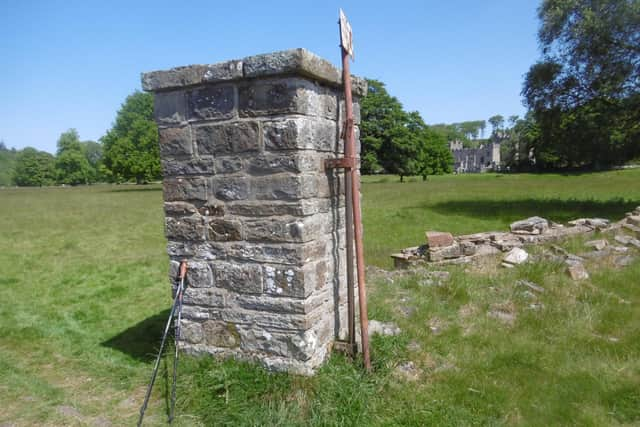
Hide AdA plaque on one of the pillars of the former main gate records the work of the camp interpreter, Capt. Herbert Sulzbach, OBE, in promoting Anglo-German reconciliation.
Featherstone Castle is just behind the camp. Like our Cresswell Tower, it began as a medieval manor house to which a pele tower was added later. It was rebuilt in the early 19th Century in a satisfyingly romantic Gothic revival style and is now a conference centre for young people.
A little further on, at a place called Bridge End, we split into two parties. The main group followed the planned walk back to the car park, taking in Featherstone Park Village on the way. Three of us took a “short cut”, following a footpath marked on the OS map. It went directly across a field, up a wooded bank and across a few more fields to the car park.
It was a mistake. The wooded bank proved to be very steep. Later, when I came to measure it at home in Google Earth, I found the gradient to be 1:4½. We knew it to be a lawful footpath, however, from the existence of occasional waymarks and from the fact that it had steps in the steepest places, made with vertical planks held in place with stakes driven into the soil, but it was a severe trial for three not very intrepid senior citizens.
Advertisement
Hide AdAdvertisement
Hide AdWhat I still can’t understand is how it ever became a footpath in the first place. The idea of pedlars with their heavy packs and packhorses with their even heavier panniers going up that precipitous bank is simply beyond me.
After that our path crossed several more fields and a small burn – which, however, once again involved a steep trudge down and a steep trudge up the other side – until we eventually came again to the former railway track. After a debate as to whether we should turn left or right along it, we found our way back to the cars.
The others, going the long way round, had got there three quarters of an hour before us.