

A map produced by Climate Central, which is based on peer-reviewed science in leading journals, forecast what could happen if the temperature rises, with areas of the coast completely submerged.
Experts have warned a rise of three degrees in global temperatures would be disastrous, with heatwaves, droughts and extreme weather events becoming more common.
It is also predicted that the coastlines today would look completely different by 2050.
Here is a look at the 2050 predictions:
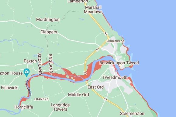
1. Berwick
By 2050, Berwick's coastline is predicted to change with significant damage hitting the River Tweed. Photo: Climate Central
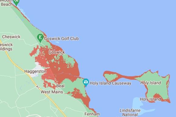
2. Beal and Holy Island
By 2050, a large chunk of the coastline at Beal is predicted to be submerged. The coastline of Holy Island will also be left under water. Photo: Climate Central
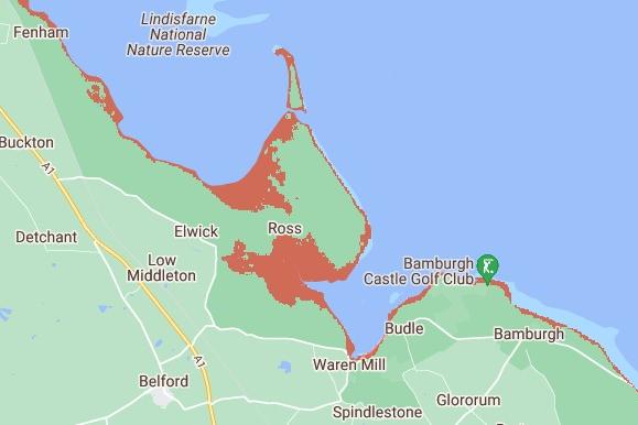
3. Ross and Bamburgh
By 2050, a significant area of Ross will be submerged. Alongside this, the coastline towards Bamburgh and Waren Mill will be pushed back due to the sea level rise. Bamburgh Castle and the golf club will take a hit and are predicted to be left under water. Photo: Climate Central
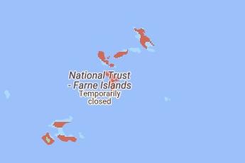
4. Farne Islands
By 2050, it is predicted that the majority of the Farne Islands will be submerged, meaning the seals and puffins will need to find a new home. Photo: Climate Central