A great, but temporary influence


Nowhere else in the Empire was such a border constructed, with all its infrastructure of roads and forts. It is quite rightly designated a World Heritage site.
Here in North Northumberland it is easy to think that we are in the area ‘beyond the wall’ and away from the influence of Rome. But that is far from the truth.
Advertisement
Hide AdAdvertisement
Hide AdIt is true that the lands south of the Wall were, in the main, brought into the Roman Empire, and for most of the 400 years of the occupation people lived here in peace and prosperity.
But the Wall didn’t represent a hard boundary.
To the north was a militarised zone, regularly patrolled by soldiers of the Roman Legions. Where we live would have been a region unique in Britain, sitting halfway between the Roman world in the south and that of the unconquered peoples in the north of this island.
The native population would probably have lived in peace with the Romans, perhaps providing food and supplies, but living as they did before the occupation, keeping many of their traditions and habits, and remaining un-Romanised.
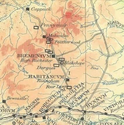
When the Romans withdrew from what we now call Scotland to build the Wall between the Tyne and Solway, they maintained a fort at Trimontium, near Melrose, to ensure they maintained influence in the regions on the edge of their Empire.
Advertisement
Hide AdAdvertisement
Hide AdThey built a road, which we now call Dere Street, to service this fort. Much of Dere Street in Northumberland today is traced out by the A68, and the remains of Roman camps can be found on either side of the road.
But it is as the road crosses the modern border, at the head of the Coquet Valley, that we find one of the most spectacular Roman remains – the camp at Chew Green.
This is, in fact, a number of camps, with earlier ones overlain by later constructions. There are none of the stone walls of Housesteads, but the earth mounds, which formed the perimeters of the camps, can be seen clearly.
Just to the north, on the crest of the ridge, is a mound which is the remains of a signalling station, showing that rapid communications were possible along the road to Trimontium – a name which refers to the three peaks of the nearby Eildon Hills.
Advertisement
Hide AdAdvertisement
Hide AdAnother road ran from the Wall near Corbridge northwards towards Berwick-upon-Tweed, where we can guess that there would have been a port of some sort, though no remains have yet been found.
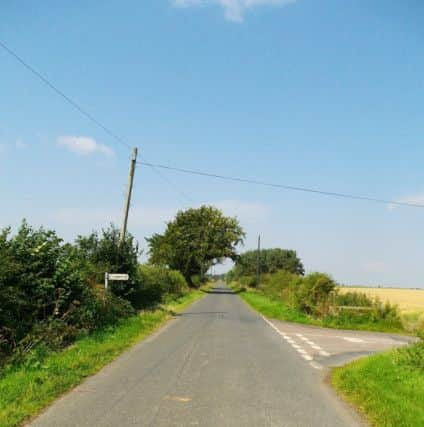
The road can be traced on the map as the Devil’s Causeway, and some sections of modern roads still follow the line of this earlier route, such as the section from East Horton to Lowick. A century and a half ago, the route could still be clearly traced in the landscape, and it was recorded by antiquarian Henry MacLauchlan in his “memoires”, but has since become much less distinct due to erosion.
The faint remains of a number of forts have been found along the Tweed using aerial photography, and we know that forts generally preceded the building of connecting roads, so there may well have been an intention to link Berwick with Trimontium. This would have provided an easy way to supply this frontier fort, but is only conjecture – whatever the plans might have been, a road was never built.
A third road joined the fort of Bremenium on Dere Street with the Devil’s Causeway, where the very faint remains of a fort have been identified near Learchild. There has been some conjecture that this road continued past Alnwick to Alnmouth, where a port could have been established, though there is no evidence on the ground.
Advertisement
Hide AdAdvertisement
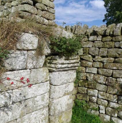
Hide AdBremenium was a stone-built fort, enough of which survives to make it an interesting place to visit. Dressed stones from the fort can be found in many local farm buildings. Today, the inside of the fort is occupied by a number of residences, including two bastle houses, and the external perimeter can be walked on a footpath.
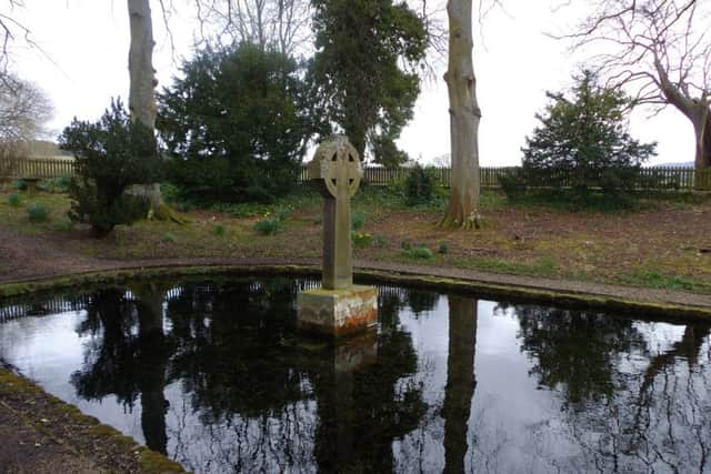
Further east, the route passes by Lady’s Well, near Holystone, which has a long history of pagan use, predating the arrival of Christianity. It was probably used as a wayside shrine during the Roman period as they had a strong tendency to adopt local gods and deities.
Just to the west, a section of the road has been exposed and we have the privilege of being able to see the foundations of the Roman road.
The period of the Romans in Britain is fascinating. They brought to this island a level of technology and civilisation previously unknown. It would be many centuries before we regained the ability to build roads and buildings that were anything close to what the Romans created.
Advertisement
Hide AdAdvertisement
Hide AdBut their influence was temporary. They were merely occupiers, staying for 400 years before departing. They left behind no real legacy, no language, and no traditions. It was the arrival of the Anglo-Saxons, and later the Vikings – settlers who merged with the native population – who would play a much more significant part in creating the Britain we know today.